

The Three Sisters Loop is a very unique backpacking trip, extremely different from what I’ve ever done. For most of the 50 mile trek, I hiked around pristine volcanic terrain of the North, Middle, and South Sisters. It was so amazing to see a hardened lava flow that looked like a river, a plethora of lava tubes, and glorious mountainous volcanoes. This scenic loop has quite diverse terrain: gorgeous rivers, emerald lakes, splendid water falls, beautiful colorful wild flower-filled meadows, stunning jagged rock formations, thousands of years old volcanoes. I was told by the ranger station that this is a must do trip in Oregon…It definitely did not disappoint! I’d do it again in a heartbeat!


My trip began at Lava Camp Lake Trailhead. There are several entry points to this loop, depending on where you want to start. You can go clockwise or counter clockwise. I opted for the former. Although, I hitched a ride to the trailhead, be sure to arrive early to get a good spot to park your car for the next few days. This loop can be done between three to six days, depending upon the side trips you want to do. Climbing one of the Sisters is an awesome side trip and one that I would highly recommend. The entire trail was up and down, but never too arduous. The trail has an incline right off the bat, but rewards you with two beautiful lakes (North and South Matthieu Lakes) within three miles of the trailhead. In a couple more miles, I reached Scott’s Pass, overlooking Mathieu Lakes, with spectacular views of Mt. Jefferson and Mt. Washington. Be aware that there is a burned section where no camping is allowed (Pole Creek Burn Area), so the first day will be close to 16 miles, unless you camp at Camp Lake (double check with the rangers), to break up the mileage.


I felt very strong at the beginning of the first day, but was quite exhausted after having to go several miles further than I had planned. You know when you get your heart set on a destination and it ends up being like a false summit? Well, that’s how I felt when I arrived at where I thought I could camp, only to read a sign that camping wasn’t allowed until I was out of the Pole Creek burned area boundary. This added several more miles to my trip that day. By the time I reached a small unnamed lake (off the Green Lakes Trail), where I could camp, I was dragging and in not such a good mood. Needless to say, I was extremely thankful for my adult beverage, of which I imbibed quite happily!


Overall, I enjoyed the sights and sounds of the hike my first day. The only part that was a real bummer was the burned section. Although disheartening to see so much land charred, it was eerily beautiful with the stark contrasts of blackened trees and the white ash covered ground. I felt as if I was in an Ansel Adams monochrome portrait. Much of this area was absent of life, with the exception of green seedling starting to grow and a few small rodents and birds flittering about. At first, I welcomed the views, but after miles and miles and miles of this section, it grew quite old and tiresome. If I were to do this again, I would skip this area all together, and start at Pole Creek Trailhead instead. Live and learn, I guess. I should’ve done a little more homework on the trail conditions. I had no idea there was even a burned section. I was told by a ranger that the fire began with a small campfire and quickly spread for miles and miles…At one point the town of Sisters was threatened. This is a prime example of someone being careless and ignorant of proper fire safety.


Water was quite plentiful along the whole trip, other than for a few miles in the burned section. Still, planning and carrying enough water is important. I finally made it to the unnamed lake shortly before dusk. It was a very quaint little lake, with several overused, but flat campsites. There are quite a few blood thirsty and vicious mosquitoes, so be sure to bring your repellant and a head net, or you’ll become a meal for many of those little buggers!

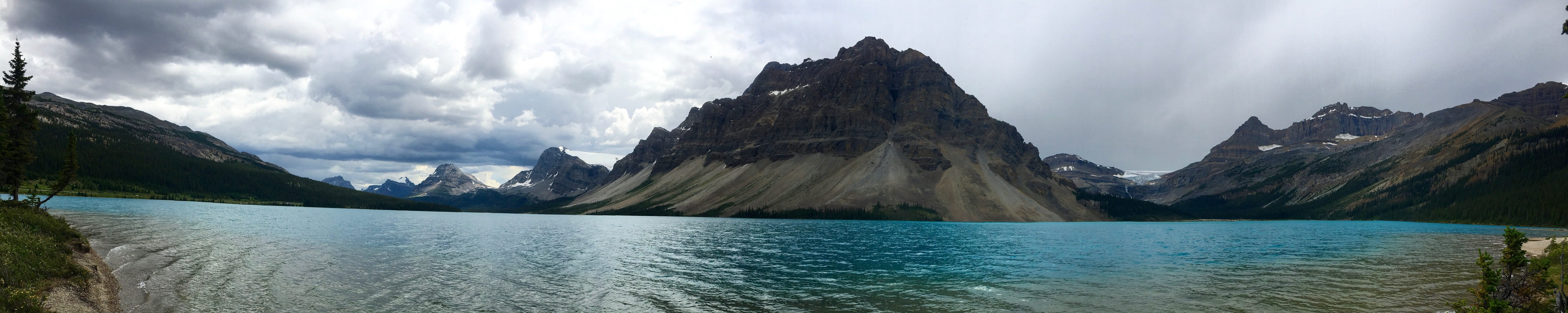
It was a wonderful calm windless night. Well rested, I woke up the next morning and set out pretty early. Today’s trip provided me with grand views of the all of the Sisters, as well as Broken Top. I also went through two glorious and expansive meadows called Red and Park Meadows! Wild flowers were abundant and the views absolutely gorgeous. I would recommend taking side trip (or camping) at Golden Lake to take in the sights even more. Also, that would allow you time to bag the one of the volcanic peaks nearby. I opted to forge on and make it to my next camping destination. I passed by Green Lakes, and as the name symbolizes, the water of the three small lakes was very green and beautiful. This area had very few trees, but was surrounded by rolling hills and mountainous peaks. There was a stunning rushing creek that you hike along for a couple of miles called Fall Creek. It is adjacent to Newberry Lava Flow. This lava flow gave me an amazing feeling of living during the stone age in a world of fire and ice. The trail is a gentle decline until you reach the Green Lake junction, then the trail turns into steep arduous switchbacks for a couple of miles until Moraine Lake. I again set up camp, but decided to “cowgirl camp”, because the weather was beautiful and sunny. I didn’t realize that a storm was headed my way! Uh-Oh! I heard the thunder roaring and bouncing off the peaks and saw the heavy dark clouds rolling my way. I was about to erect my tent, but the mountains surrounding me kept the storm at bay. It ended up being a wonderful night beneath the stars.


The next morning, I packed up camp, resupplied my water, and headed out. My third day was probably my most difficult because of the up and down nature of the trail and the warmth of the temperature. I did 12 miles today, and felt every one of them. I don’t know about you, but some days I feel very strong and other days, I feel weak, out of breath, and disheartened. This was one of those times. The terrain was again fantastic however, and the lava and volcanic peaks were absolutely fascinating. Water was a little more scarce in this section, like the burned out area, but nothing that needed concern. There are little creeks and streams here and there. I hiked in a huge plateau prairie (Wickiup Plain) area for miles with the Sisters, now to my right, as I was making the loop back around them. A wonderful lake to have lunch at was Reese Lake. I ended up camping at a secluded spot about 100 yards off trail near Linton Meadows. Here the view of the Husband and valley below were outstanding. Today, I very much enjoyed my Rumchata mixture and went to bed quite early. Mosquitoes were dive bombing me, but I still “cowgirl camped”! I wore my head net to bed because they wouldn’t leave me alone. Boy, did I look sexy! Hahahaha!


Because I was ahead of schedule and had done more miles than planned on the previous days, I decided to make it back to the trailhead on my fourth day. I didn’t want to rush this amazing trip, but Mexican food and a warm shower were calling to me. Can you blame me?

I thoroughly enjoyed my last day. Before I arrived at Obsidian Dome, there was a beautiful waterfall surrounded by lush green ferns. There were a couple of rangers in this area checking for Obsidian permits because it is a limited entry area and you’re only allowed to park/camp with a permit. The Obsidian Dome permits must be reserved ahead of time, and are difficult to get. If you are just walking through, a permit is not needed. It was the only time that my self-issued permit was checked. The rangers were very amiable! The Obsidian Trail was breathtaking. The black obsidian shone like diamonds on the hills surrounding the lush green meadow where the trail weaved in and out. There was a little stream that gently flowed right next to the trail. This scenery made me feel as if I were in the land of Hobbits and headed toward the Shire…Nothing short of spectacular.


I thought that was going to be the climax of the trip, but I was wrong. All of a sudden the terrain became barren, rocky with a red hue, and then I came upon an amazing lava flow of Ahalapam Cinder Field and Yapoah Crater. It was astonishing how long and wide this flow was…It went on for miles. I could just imagine being there to witness the eruption and flow thousands of years ago. What a grand sight that must have been! The trail was very steep out of the lava flow, but then leveled off once I made it to the valley floor. The topography again changed to more vegetation, rivers, and lakes. Once I arrived again at Matthieu Lakes, I knew I was close to the trailhead, and Mexican food! I needed to get a ride back to town which was about 13 miles away. Thankfully, I came upon an older couple who had been out on a day hike. They were very gracious “trail angels” and brought me back into town. They were such a wonderful couple. I very much wish I could remember their names!


Overall the backpacking trip was a huge success. It had such diversity and breathtaking scenery. I found myself just staring, mouth gaping, in wonder and amazement. I definitely recommend this trip to anyone wanting to experience Oregon and it’s spectacular volcanoes! Adios for now…It’s margarita time!!! Salud!

Happy Trails! ~Solo Yolo
Permits: Self Issued at Lava Camp Trailhead/If entering through Obsidian Trailhead, permits required (reservations 30 days in advance). Note: Beginning in 2020, permits will no longer be self issued. Deschutes NF Info (Permits/Passes)
Ranger Stations: Sisters Ranger District, (541) 549-7700 and McKenzie River Ranger District, (541) 822-3381
Excellent resources:
