A Learning Experience on San Bernardino Peak (10,649’/4650′ elev gain/16 mi)

What started as a beautiful weekend of hiking and climbing, almost turned into a deadly event.  I am being a little over-dramatic, but with good reason as you will soon see.

San Bernardino Peak is a yearly trek which I take to complete the Six Pack of Peaks Challenge for SoCal Hikers, and to get into shape for my summer excursions.  I was a little hesitant to go this time of year because I wasn’t sure what the trail conditions were like near the summit.  I had put some “feelers” out in various Facebook groups, did my research as best I could, and decided to go ahead and go.  I told myself that if the conditions were too dangerous or the snow too arduous to hike through (endless post-holing), I would suck up my pride, submit to Mother Nature and turn around.

I knew a woman from Facebook,  hiking the mountain on the same day as I was.  We actually arrived at the trailhead the same time, around 8:30am on Saturday, March 24th.  Great timing, and so I was able to meet her at the trailhead. I do enjoy my alone time, so I opted not to hike with her group of 10, but knew I’d see them at Limber Pines Bench Camp, and could chat with them then.

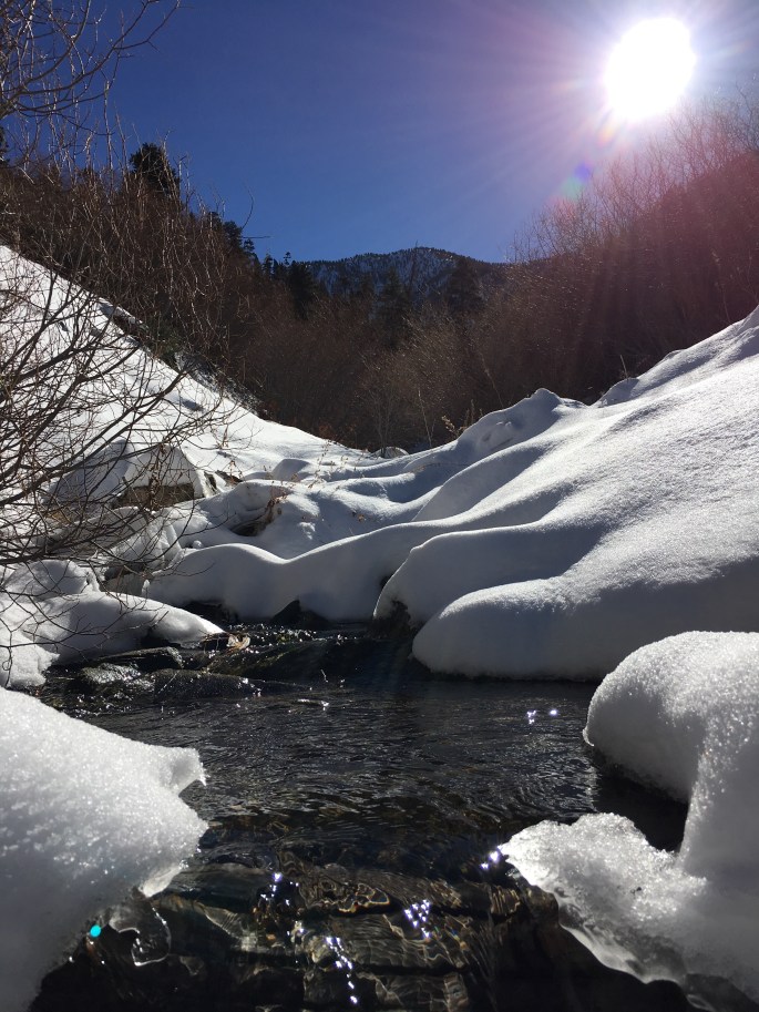
It was a cool brisk morning, and not as much snow as I expected to encounter at the lower elevations.  The endless switchbacks, until Manzanita Flats, had me ripping off my layers, chugging down the water, and sucking up the air around me.  At around 8,000 ft, the trail turned to hard pack snow and continued as such until about 100 feet below Limber Pines Bench, where it turned to windswept ice from the freeze/thaw conditions and high winds.  I did not put on my crampons, but dug my boots deep into the snow with every step near camp.  I would later reflect back upon this decision, and how foolhardy it was not to stop, just take a brief moment, and put on my crampons.

IMG_1336

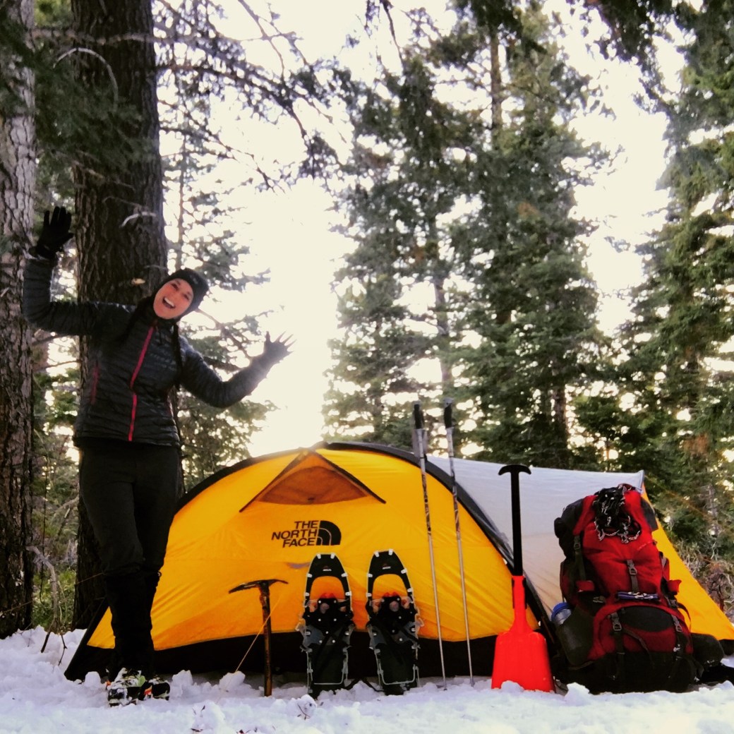
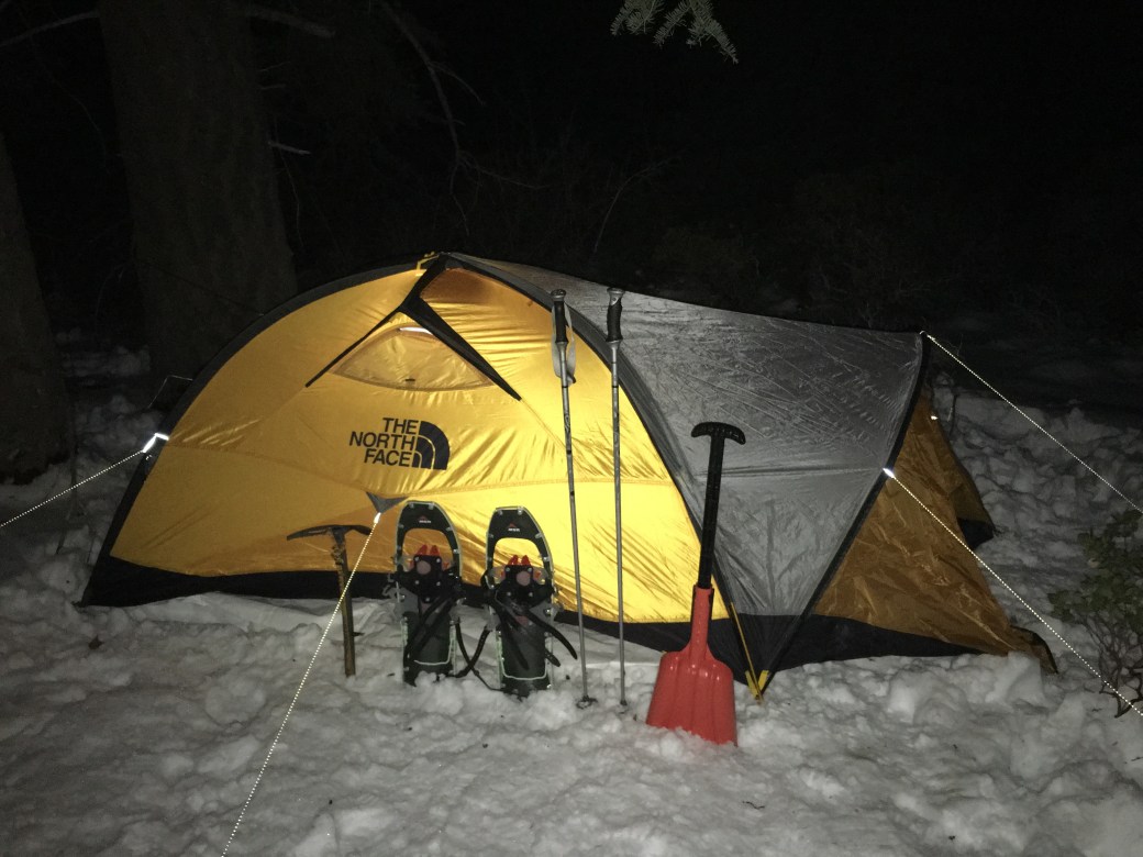
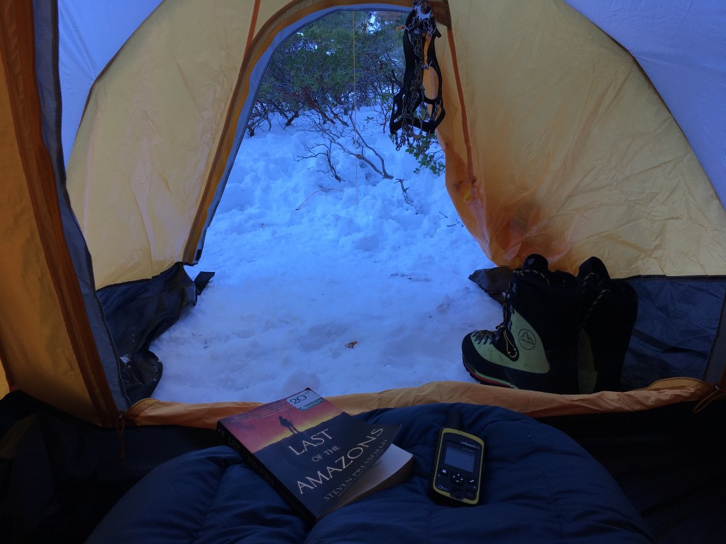
I made it into Limber around 12:30 pm and proceeded to set up camp and wrestle with erecting my four-season tent. It’s an awesome tent, but a pain to set up.  The winds started to increase and the fog soon moved in.  At this saddle, the winds and weather can be quite ferocious because it’s so exposed.  We were expecting 45+ mph winds, single digit windchill temps, and 10% chance of moderate snow.  A couple of hikers asked me if I wanted to climb with them to the summit that afternoon, but I declined because of the winds and incoming clouds.  I hoped that the following day would be a better day to summit.  I battened down the hatches and took a light nap.  Right before sunset, I got ready for a long night in the tent, and snapped a couple of pictures of the sunset.  It was a long and chilly night, but alas…Daybreak came soon enough.

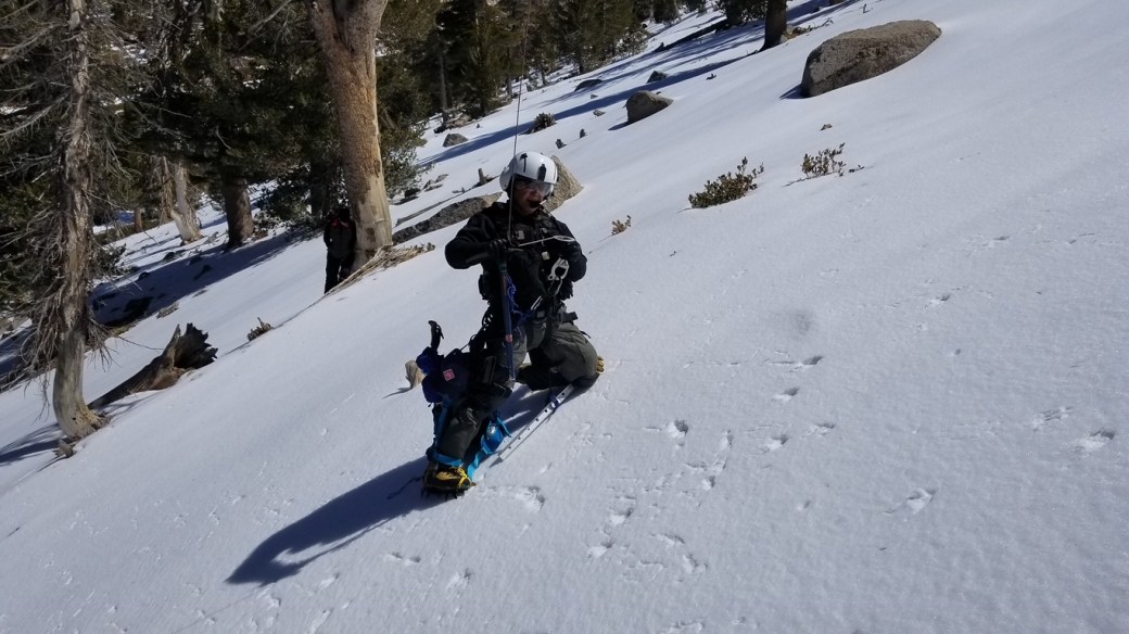
I still wasn’t sure I wanted to head up to the summit, but I spoke to the trio who summited the day before, and they said the conditions were good for climbing with crampons.  Three hikers ended up joining me from the group.  Hindsight, I was very thankful to have the company.  We left camp at around 8am, and made our way straight up the main chute. The crampons dug in well in most spots, and the other harder areas, you had to really make a concerted effort to dig in to gain purchase.  The main chute wasn’t overly steep, just a constant ascent.  We decided to take a smaller chute to the left for a direct path to the summit.  This chute was steeper and the ice was harder because it was a little more exposed to wind.  The weather was beautiful: sunny, light wind, and warm on the ascent.  We soon made it to the summit, snapped a couple of pics, congratulated each other, and headed back down before our finger tips fell off from frostbite.  Okay, I’m exaggerating again. =) It was damn nippy!

On the way down, I was chatting happily with my partner when I tripped over my other crampon, and immediately starting sliding down the main chute.  I didn’t slide far before I flipped over and self-arrested.  It was a little disconcerting, but good practice. Murphy’s law is always present in my life, as I was just talking about self-arresting techniques with my buddy previous to my slide. Haha! We made it back to camp, taking about 3 hrs round trip. I took off my crampons and began to pack up for the descent back down to the trailhead.

As I was deciding what I wanted to pack up first, two young women approached me and asked if I was leaving.  I thought it an odd question, and was wondering if they wanted my camp spot, but they did not have overnight gear.  The duo then told me that another woman, who they were talking to on the trail, had shifted her weight, and subsequently, slid several hundred feet down the steep icy slope. She (Michelle) stated that the woman was most likely in serious condition, because she had hit a few obstacles on the way down.  They could not attempt to rescue her because, like the victim, they only had micro spikes on.  I immediately requested that my two hiking buddies join me to help (power in numbers/knowledge/experience), put on my crampons, and assembled some of my measly first aid equipment.

I then hiked down to where the main trail makes it’s last ascent into Limber, approximately 100 feet downslope.  I could not see the victim, nor could I hear her from this vantage point. The two women, Michelle and Chelse, pointed to where the victim (Rachel) had stopped.  I hiked up the steep icy slope and found that she had come to rest behind a tree.

This woman had fallen more than 500 feet, hit a tree and a few rocks along the way down.  She flew over a natural rock ramp and head first into a tree, which finally broke her fall (slide).   She was in shock, but coherent, and was able to answer my questions with a some difficulty.  The victim had multiple injuries, including a two-inch gash in her head, a broken wrist, and was bleeding pretty badly from her elbow, along with other unknown injuries. Rachel, the victim, was also complaining of back pain, but thankfully, could move her extremities.  Michelle, miraculously a trauma nurse, was assisted up to the location by my hiking buddy, Julian.  As first responders, we administered first aid, cleaned her up, and Chelse called SAR from the trail below.

Photo Mar 25, 12 38 19 PM

The immediacy of the Search and Rescue Team is to be commended.  They, along with a sheriff’s helicopter, were at the accident site within the hour.  I was very impressed with not only the response, but also the professionalism and expertise of the SAR Team.  They airlifted the victim and took her to a nearby hospital.  She had remained conscious the entire time, stated that she was afraid, but was calm even though she was in excruciating pain.  We had called her boyfriend and told him where she’d be.  We knew Rachel was in good hands when we last saw her being drawn into the helicopter.

Photo Mar 25, 12 33 28 PM

The first responders were grateful to one another for helping a fellow human being, and remaining calm throughout the entire ordeal.  We helped save a life that day.  It’s what we do for each other.  Rachel could not be seen or heard from the main trail.  She was traveling alone, and had limited cell reception.  There was no way, without assistance, that she could’ve made the climb down to the main trail. It was forecasted for one degree windchill temps that night.  She had a cotton sweatshirt on, and most certainly could’ve died of exposure if SAR or others hadn’t come to her rescue. Although she was in serious condition, she was extremely blessed that day.

This was a learning experience for everyone involved, and could’ve happened to any of us, even with experience and proper gear. However, the chances of getting hurt are greatly increased from not having the right gear that fit the conditions, and not knowing how to use them.  The victim had micro spikes on a steep slope, and poles with rubber attachments still on the ends.  Micro spikes are ineffective on icy steep slopes.  The victim, as she was falling, was not able to self arrest.  She hit head first into a tree. Helmet, ice axe, and crampons were mandatory with the steepness and icy conditions of the terrain.

In reflecting upon this almost tragic incident, I came to the realization that gear, experience, and having buddies when winter mountaineering is vitally important, and could make the difference between life and death.  Personally, I did not bring my helmet.  My excuse: in order to reduce the weight I had to carry…Bad mistake #1.  I went solo…Bad mistake #2.  I had my InReach with me, but failed to leave an exact itinerary with my family.  They erroneously thought I was on San Gorgonio…Bad mistake #3. Although, I value my alone time on the trail, and will never give that up, I will make a concerted effort to have fellow hikers join me on my winter excursions from this point forward.

It is my hope that by telling this story that others will see through my eyes, and think twice about what is needed in the wilderness, and especially during the winter season.  Preparation, knowing your limits/comfort zone, and experience will enable you to hike yet another day.

IMG_0078

I would like to extend a very special thank you and my utmost gratitude to the victim (for being a strong and calm woman), Michelle (heaven sent nurse), Chelse (her friend who directed SAR to our location, Julian and Kirk (my hiking buddies), The Mountain Humpers (helping to flag down the air vac), and most of all the SAR Team (San Bernardino Sheriff’s Dept, Sheriff’s Air Rescue (AR306))  who risked their lives to save a fellow hiker! Everyone was amazing, and helped this accident come, not to a tragic ending, but a positive one. ❤

IMG_0082

Happy Trails and Stay Safe! ~SoloYolo

Canada or Bust! (Jasper National Park)

Continuing our trip in Canada, we traveled from Banff National Park to Jasper National Park, along the Icefields Parkway, (Hwy 93).  Before embarking on this grand tour, I did a lot of research and made camping reservations for along the way.  Although I did pretty well in my planning, I was not prepared at the sheer distance between the parks.  It took about 4 hours to drive into Jasper, which looked like a mere hop, skip, and jump on the map.  We did not mind at all, however, because the drive was absolutely stunning and such a voyeur’s rush!  Along the route to Jasper, I viewed sharp granite peaks, endless valleys, huge glaciers, emerald blue lakes, swollen rushing rivers, beautiful lush green forests, and amazing forest animals, like bears, mountain sheep, and Canada geese.  I was as giddy as a young child going to Disneyland for the first time.  My eyes were in stimulation overload at the spectacular scenery of the Icefields Parkway.

The campground that we stayed was Whistlers Campground.  This was a wonderful campground! The sites were large and somewhat secluded.  It was a very foresty and quiet campground.  There were little hobbit trails throughout the camp to take easy and enjoyable strolls through.  The amenities were excellent (wash rooms, hot showers, playground, firewood for sale, interpretive walks, etc.). The best experience at this campground was the huge herd of elk that came to visit as the sun was setting…Absolutely awesome!!!

The town of Jasper is quite quaint, but teeming with people…Not as many as Banff, so it was very tolerable.  I must say that the Canadian people are very welcoming and truly appreciate the tourists.  I visited the Jasper Park Information Centre to ask questions about transportation to and from the Skyline Trail, because my son and I were going to backpack the 30 mile trail in a few days.  The ranger was very informative and answered all my questions thoroughly.  A couple of noteworthy restaurants were: Jasper Brewing Company, Bright Spot Family Restaurant, and Bear’s Paw Bakery.  I did not eat out much because I had an RV to cook my meals in, so these are definitely not an exhaustive list, but ones that I found very delicious!

We spent a couple of days exploring Jasper National Park.  We visited Athbasca Falls, Sunwapta Falls, and Jasper Lake.  The falls were spectacular, with the stunning mountain backdrops, and the deep gorges forged by glaciers and the glacial river.  I was blown away by the sheer power of the rushing water!  The bridges and walkways were a little more extensive at Athbasca Falls, but both areas provided beautiful views of the forces of nature.

Jasper Lake was remarkable as well.  It is actually part of the Athbasca River.  We walked quite aways out and were only knee-high deep in the water.  Jasper Lake Sand Dunes is the only sand dune ecosystem found in the Canadian Rockies.  The dunes were formed during the last ice age, and have been reshaped by water and wind ever since.  The dunes provided a stark contrast to the Canadian Rockies, which surrounded them.  The lake acts like a sieve for the silt and sand that come off the dunes.  I guess that’s the reason it’s such a shallow lake.

Two other lakes we visited were Medicine and Maligne Lakes, along the scenic Maligne Lake Road.  Medicine Lake is a geologic anomaly, because it isn’t really a lake, but a huge drainage basin for the surrounding peaks and glaciers.  It is actually part of Maligne River, which flows from Maligne Lake into the Athabasca River.  During the summer months, the “lake” fills with meltwater runoff, but slowly drains into aquifers, becoming a river with small pools.  The underground water system is one of the most extensive in the world.  Medicine lake is a gorgeous “lake” with quite a story behind it.

DSC_0482
Medicine Lake


Maligne Lake is a resort and photographers paradise!  It is famous for the color of its water, the surrounding glaciated peaks, and Spirit Island.  It is coined as the largest glacial fed lake. Wildlife is abundant around the lake (bears, caribou, wolves, moose, mountain sheep, eagles, osprey, Canada geese, etc.). There are plenty of activities and services offered at the lake.  Shuttle buses are available from Jasper, and boat tours are also available that run to Spirit Island from spring to autumn.  There are boat and kayak rentals, as well as a gift shop and restaurant at the lake. There are two campgrounds available near the lake, Coronet Creek and Fishermen’s Bay Campgrounds. It would be very easy to spend a week at this lake just hiking, fishing, and boating.  Maligne Lake was one of my favorites in Jasper NP.  It’s another must visit attraction in Canada!

I could definitely live in Jasper…My kind of national park, quaint town, and mountainous topography.  The town and park have so much to offer, from spectacular scenery to activities that challenge anyone’s sense of adventure! We spent a week here, but I could spend a lifetime!!!  Canada please take me away! ❤   Happy Trails! ~Solo Yolo

IMG_4403
Canada geese at Maligne Lake

To Do Canada

Jasper National Park (Plan your Visit)

Backcountry Camping Reservations

Athabasca Falls

Sunwapta Falls

Sunwapta Accomodations

Maligne Lake (Attractions/Sightseeing)

Maligne Lake (Campgrounds/Hiking)

Medicine Lake


3-Day Winter Mountaineering Course in the Sierra (Twin Lakes, Bridgeport, CA)

I’ve been winter snowshoeing and camping on many occasions, but this was the first time in eXtreme conditions.  The Sierra Mountains are as stunning and spectacular as they are relentless and unforgiving.  We are but mere specs in its vastness and power…As it very well should be.  

img_0203
Twin Lakes/Mono Village (Bridgeport, CA)

I had been looking forward to this trip for several months.  I conducted a winter equipment research, bought high quality gear, and tested it out in my local mountains.  Now, consequently, I’m in the poor house, and must sell my first born! 😉 It’s amazing how expensive gortex and waterproof gear are! Wow! Plus, of course, I purchased many items at the height of the season.  My lot in life! Haha!  Finally the weekend came.  I was a little nervous at the prospect of climbing, as I am a hiker, not a mountain climber, but I thought that this was a perfect time to fine tune my winter backpacking skills, as well as to broaden my horizons, and maybe, just maybe, find a new hobby.  You know what that means…More gear!!!  

I drove to Bridgeport, rather early the day before the trip, because I wanted to make it to my destination prior the snow storm and before Hwy 395 could close down.  I reserved a quaint cabin room at Virginia Lakes Settlement.  Virginia Lakes Settlement Motel is quite the find, and a precious little gem!  It has it’s own restaurant, motel rooms, and small cabins along side a small gently flowing creek.  It is only a couple miles from Bridgeport and half the cost of the lodging in town.  

I ate a wonderful meal in the restaurant, then hit the sack early so that I could be well-rested for my adventure.  Unfortunately, I had difficulty sleeping that night because I was so damn excited! I woke up to repack my backpack at 2am.  I know, crazy! I tried to figure out items that I didn’t need in order to make my pack lighter.  I am always amazed at how heavy winter backpacking is!  My backpack had to weigh between 50-55 lbs after I took out a few things. That’s it!  I am going to build a sled for next year’s winter excursions!

Finally, the morning came and I actually made it to the meeting place (Ruby Inn) on time! WhooHoo! Things were falling into place.  I met the two mountain guides (Joe/Ross) and the other clients.  The guides handed out gear and also checked to make sure we had what we needed for winter mountaineering.  After about two hours, we caravanned to Twin Lakes/Mono Village to embark upon our journey.

The first part was a meadow, very flat and extremely easy.  I said to myself…Oh, this is going to be a “cake walk”! Hahahaha…Not! We quickly crossed a log bridge, tested our beacons, and then it was up, Up, UP!  Switchback after switchback, up the ridge, we went. Tirelessly, we pushed.  Along the way,  we were like the hobbits with first, second, and third lunches.  A glorified, 10 minute stop here and there to drink, eat, and rearrange gear.  The guides were slave drivers! Hahaha! I can honestly say that all of us were working hard and huffing and puffing, even the guides!  One of my fellow hikers said that he went from a kid to an old man on the course of the trek to our camp.  I thought he meant that he was giddy at beginning, but he meant that he complained like a kid would, which was then transformed to that of the complaints of an old man! He provided me a great description of how he felt and many others, including me a “tad bit” at times! Haha! After several hours of postholing, slipping, sliding, digging in deep with every step in our snowshoes…We finally made it to camp! WhooHoo! I was so excited that I brought out my Rumchata in celebration.  The tribe was a little reluctant to try my milky goodness…But hey, all the more for me right?!!

We each picked out a spot for our tents and erected them.  Mine took quite sometime because of all the tie downs, which would become a problem on the last day.  I chose what I thought was a perfect spot, but hindsight…It was not the best.  Now, I know to pay closer attention to wind direction and choose a spot that doesn’t have a slope and is better protected by trees.  It’s all about the learning experience, right? After setting up our tent, bedding and living area, we dug out a kitchen and privy for our use for the rest of the trip.  The storm blew in by this time, so we spent dinner and the rest of the evening trying to keep warm.  Dinner (vegetarian mac-n-cheese) was good, but cold because of the outside temps.  Needless to say, we hit the hay early, plus we were going to get up a 3:30am, if the weather cooperated in order to climb Matterhorn Peak (12,267′).  Evening was uneventful, and as always, I tossed and turned.  I had never had a tent buddy who I didn’t know before, but he (Alex) ended up being a wonderful companion.  He never moved an inch at night, nor did he snore! Plus, we engaged in some damn good conversation.  He was perfect!  The wind howled all night and a fair amount of snow fell.  I had the feeling that we were not going to be able to summit the next day. Ahhhhh, the sweet feeling of being able to sleep in!  Priceless!!!

Because of the weather and avalanche danger, we were able to sleep in and have a relaxing breakfast. After breakfast, we put on our snowshoes, with ice axes and shovels in hand. The guides lectured us about avalanche awareness, finding a buried beacon, and the importance of getting to a victim within 15 min. if possible.  We also learned how to self-arrest and build snow shelters (snow trench and snow cave).  It was a very productive day and I learned a wealth of knowledge about backcountry winter camping/hiking.  The day was cut short because the brunt of the storm moved in.  We climbed in our tents at around 4pm. The guides delivered our dinner to the tents.  The dinner was absolutely delicious (salmon/sun dried tomatoes/walnut/parmesan cheese pasta).  The meal was hot and succulent.  Hands down, it was one of the best meals I’ve ever had in the backcountry.

That night, the winds were hellacious and the drifting snow sounded like waves crashing against the tent.  A couple times the wind became so severe that I thought I was going to become Dorothy and find myself in the land of OZ.  Again, it was a restless evening.  At 7am, the guides came through and told us that we needed to tear down camp quickly because the storm was not letting up and blizzard conditions were forming.  Over 100 mph winds were recorded on some of the Sierra peaks later that day!  I had to dig myself out of the tent because of the snow drifts and new fallen snow.  Because of the location I picked, as well at how deep we dug the stakes, it was very difficult to retrieve them.  We had to dig quite deep to get them out.  I learned to pick a spot that is a little more sheltered and not to bury the stakes quite so deep.  I had to ask others for help to get the tent torn down, because everyone was standing around waiting  for us.  It was a pretty stressful moment with the wind, snow, and time constraints.  Because of trying to get to lower elevation quickly, we did not make breakfast, and worse yet…No COFFEE! Ugggghhhh, this woman does not do well un-caffeinated.  But alas, I did survive.

DCIM100GOPROGOPR1476.
Stormy Sierra Sunset

We left camp and encountered white out blizzard conditions, until we hiked to a lower elevation.  It was a very hard snowshoe trip out because of the deep powder.  We were slipping along the side slope and sinking in…Even the guides were having a tough time.  The lead guide mentioned that he loves guiding people, but that he never would have gone mountaineering on a day like this.  Unfortunately when you make advance reservations, you have no idea what kind of weather you will encounter.  I was unable to capture photos of the blizzard because of technical difficulties (batteries) and time constraints, but it was definitely “Nature’s Fury” out there!  I’m glad that I picked a wild weather weekend…It gave me the skills and confidence to be able to handle severe weather in the future.  Weather can change in a moment and it’s always beneficial and necessary to be prepared.

By the time we got out of the weather and into the trees, we were soaked inside out.  All of us were thankful when the cars and civilization came into view.  Even though the weather didn’t cooperate, the trip was exciting and the knowledge I gained will aid me in my future endeavors.  All of the people on the trip were wonderful and very helpful!  What a awesome experience it was!  I’d do it again in a heartbeat.  My only complaint was that I wasn’t able to learn any climbing or crampon techniques…I guess that leaves something to learn and experience for next time!

Happy Trails! ~Solo Yolo

Guiding Company Critique:  The Intro Mountaineering Course I took was through International/California Alpine Guides.  Overall, the rating I give them is 6/10.  The paperwork, prior to the trip, was streamlined and flawless.  The company and the lead guide called me a week before the trip to touch base and answer any questions I had.  The guides were very personable, and  knowledgable about avi training and winter survival.  I am confident that they would have been adept at teaching me climbing techniques as well. Some of the negatives were that the guides (company) weren’t as well prepared as I would’ve wanted (forgotten items and gear not tested before the next trip) and the equipment, which other clients borrowed, was quite old and in need of repair.  I had all my own gear, so this was not an issue for me.  Some of the items forgotten were: climbing rope, batteries for headlamp, tent vestibule poles, shovel, ice axe, coffee filters, etc.)  Granted, many of the clients requested a lot of gear, but a thorough check by the hired guide company of the equipment and supplies should be of paramount importance.  Other clients I have spoken to say nothing, but good things about this company.  This might have been a rare occurrence, but one that left me a little dissatisfied. There are many guiding companies in the area, which I will list below.  This is not an exhaustive list, but one to start from.  Do your research and choose one that fits your needs and whom you feel comfortable with.

International Alpine Guides

Invaluable Resource: Ned Tibbits, Director at Mountain Education, Inc. is extremely knowledgable of the area and wilderness safety and skills.  His company is based out of South Lake Tahoe and provides clinics in the Sierra as well as WA.  His focus is long haul hiking and being able to be successful in the backcountry for periods of longer than 30 days.  He comes highly recommended and a must for people wanting to thru-hike.  I am planning to take a course through his company, even though my longest planned hike will be the JMT.  I follow him on FB, and he is an invaluable resource.

Mountain Education, inc.

Trip information:

Lodging: Virginia Creek Settlement

Directions: Bridgeport to Mono Village

Mono County Tourism: Horse Creek Trail

Great Eats: Rhino Bar and Grille

Other Local Alpine Guides:

Sierra Mountain Guides

Sierra Mountaineering International

Alpine Skills International

SWS Mountain Guides

Three Sisters Loop, OR (50 mi/4 days/7000′ elev gain)

The Three Sisters Loop is a very unique backpacking trip, extremely different from what I’ve ever done.  For most of the 50 mile trek, I hiked around pristine volcanic terrain of the North, Middle, and South Sisters.  It was so amazing to see a hardened lava flow that looked like a river, a plethora of lava tubes, and glorious mountainous volcanoes.  This scenic loop has quite diverse terrain: gorgeous rivers, emerald lakes, splendid water falls, beautiful colorful wild flower-filled meadows, stunning jagged rock formations, thousands of years old volcanoes.  I was told by the ranger station that this is a must do trip in Oregon…It definitely did not disappoint! I’d do it again in a heartbeat!


My trip began at Lava Camp Lake Trailhead.  There are several entry points to this loop, depending on where you want to start.  You can go clockwise or counter clockwise.  I opted for the former.  Although, I hitched a ride to the trailhead, be sure to arrive early to get a good spot to park your car for the next few days. This loop can be done between three to six days, depending upon the side trips you want to do. Climbing one of the Sisters is an awesome side trip and one that I would highly recommend.  The entire trail was up and down, but never too arduous.  The trail has an incline right off the bat, but rewards you with two beautiful lakes (North and South Matthieu Lakes) within three miles of the trailhead.  In a couple more miles, I reached Scott’s Pass, overlooking  Mathieu Lakes, with spectacular views of Mt. Jefferson and Mt. Washington. Be aware that there is a burned section where no camping is allowed (Pole Creek Burn Area), so the first day will be close to 16 miles, unless you camp at Camp Lake (double check with the rangers), to break up the mileage.


I felt very strong at the beginning of the first day, but was quite exhausted after having to go several miles further than I had planned.  You know when you get your heart set on a destination and it ends up being like a false summit? Well, that’s how I felt when I arrived at where I thought I could camp, only to read a sign that camping wasn’t allowed until I was out of the Pole Creek burned area boundary.  This added several more miles to my trip that day.  By the time I reached a small unnamed lake (off the Green Lakes Trail), where I could camp, I was dragging and in not such a good mood.  Needless to say,  I was extremely thankful for my adult beverage, of which I imbibed quite happily!


Overall, I enjoyed the sights and sounds of the hike my first day.  The only part that was a real bummer was the burned section.  Although disheartening to see so much land charred, it was eerily beautiful with the stark contrasts of blackened trees and the white ash covered ground.  I felt as if I was in an Ansel Adams monochrome portrait.  Much of this area was absent of life, with the exception of green seedling starting to grow and a few small rodents and birds flittering about.  At first, I welcomed the views, but after miles and miles and miles of this section, it grew quite old and tiresome.  If I were to do this again, I would skip this area all together, and start at Pole Creek Trailhead instead.  Live and learn, I guess.  I should’ve done a little more homework on the trail conditions.  I had no idea there was even a burned section.  I was told by a ranger that the fire began with a small campfire and quickly spread for miles and miles…At one point the town of Sisters was threatened.  This is a prime example of someone being careless and ignorant of proper fire safety.


Water was quite plentiful along the whole trip, other than for a few miles in the burned section.  Still, planning and carrying enough water is important.  I finally made it to the unnamed lake shortly before dusk.  It was a very quaint little lake, with several overused, but flat campsites.  There are quite a few blood thirsty and vicious mosquitoes, so be sure to bring your repellant and a head net, or you’ll become a meal for many of those little buggers!

img_3260-copy
Unnamed lake off of Green Lake Trail

It was a wonderful calm windless night.  Well rested, I woke up the next morning and set out pretty early. Today’s trip provided me with grand views of the all of the Sisters, as well as Broken Top.  I also went through two glorious and expansive meadows called Red and Park Meadows!  Wild flowers were abundant and the views absolutely gorgeous.  I would recommend taking side trip (or camping) at Golden Lake to take in the sights even more.  Also, that would allow you time to bag the one of the volcanic peaks nearby.  I opted to forge on and make it to my next camping destination.  I passed by Green Lakes, and as the name symbolizes, the water of the three small lakes was very green and beautiful.  This area had very few trees, but was surrounded by rolling hills and mountainous peaks.  There was a stunning rushing creek that you hike along for a couple of miles called Fall Creek.  It is adjacent to Newberry Lava Flow.  This lava flow gave me an amazing feeling of living during the stone age in a world of fire and ice.  The trail is a gentle decline until you reach the Green Lake junction, then the trail turns into steep arduous switchbacks for a couple of miles until Moraine Lake.  I again set up camp, but decided to “cowgirl camp”, because the weather was beautiful and sunny.  I didn’t realize that a storm was headed my way! Uh-Oh! I heard the thunder roaring and bouncing off the peaks and saw the heavy dark clouds rolling my way.  I was about to erect my tent, but the mountains surrounding me kept the storm at bay.  It ended up being a wonderful night beneath the stars.


The next morning, I packed up camp, resupplied my water, and headed out.  My third day was probably my most difficult because of the up and down nature of the trail and the warmth of the temperature.  I did 12 miles today, and felt every one of them.  I don’t know about you, but some days I feel very strong and other days, I feel weak, out of breath, and disheartened.  This was one of those times.  The terrain was again fantastic however, and the lava and volcanic peaks were absolutely fascinating.  Water was a little more scarce in this section, like the burned out area, but nothing that needed concern.  There are little creeks and streams here and there.  I hiked in a huge plateau prairie (Wickiup Plain) area for miles with the Sisters, now to my right, as I was making the loop back around them.  A wonderful lake to have lunch at was Reese Lake.  I ended up camping at a secluded spot about 100 yards off trail near Linton Meadows.  Here the view of the Husband and valley below were outstanding.  Today, I very much enjoyed my Rumchata mixture and went to bed quite early.  Mosquitoes were dive bombing me, but I still “cowgirl camped”!  I wore my head net to bed because they wouldn’t leave me alone.  Boy, did I look sexy!  Hahahaha!


Because I was ahead of schedule and had done more miles than planned on the previous days, I decided to make it back to the trailhead on my fourth day.  I didn’t want to rush this amazing trip, but Mexican food and a warm shower were calling to me.  Can you blame me?


I thoroughly enjoyed my last day.  Before I arrived at Obsidian Dome, there was a beautiful waterfall surrounded by lush green ferns.  There were a couple of rangers in this area checking for Obsidian permits because it is a limited entry area and you’re only allowed to park/camp with a permit.  The Obsidian Dome permits must be reserved ahead of time, and are difficult to get.  If you are just walking through, a permit is not needed.  It was the only time that my self-issued permit was checked.  The rangers were very amiable!  The Obsidian Trail  was breathtaking.  The black obsidian shone like diamonds on the hills surrounding the lush green meadow where the trail weaved in and out.  There was a little stream that gently flowed right next to the trail.  This scenery made me feel as if I were in the land of Hobbits and headed toward the Shire…Nothing short of spectacular.


I thought that was going to be the climax of the trip, but I was wrong.  All of a sudden the terrain became barren, rocky with a red hue, and then I came upon an amazing lava flow of Ahalapam Cinder Field and Yapoah Crater.  It was astonishing how long and wide this flow was…It went on for miles.  I could just imagine being there to witness the eruption and flow thousands of years ago.  What a grand sight that must have been!  The trail was very steep out of the lava flow, but then leveled off once I made it to the valley floor.  The topography again changed to more vegetation, rivers, and lakes.   Once I arrived again at Matthieu Lakes, I knew I was close to the trailhead, and Mexican food!  I needed to get a ride back to town which was about 13 miles away.  Thankfully, I came upon an older couple who had been out on a day hike.  They were very gracious “trail angels” and brought me back into town.  They were such a wonderful couple.  I very much wish I could remember their names!


Overall the backpacking trip was a huge success.  It had such diversity and breathtaking scenery.  I found myself just staring, mouth gaping, in wonder and amazement.  I definitely recommend this trip to anyone wanting to experience Oregon and it’s spectacular volcanoes!  Adios for now…It’s margarita time!!! Salud!

img_3796
Back to the Lava Camp Trailhead! It’s all about the journey…Although making it to the destination isn’t too bad either! 😉

Happy Trails!  ~Solo Yolo

Permits: Self Issued at Lava Camp Trailhead/If entering through Obsidian Trailhead, permits required (reservations 30 days in advance). Note: Beginning in 2020, permits will no longer be self issued. Deschutes NF Info (Permits/Passes)

Northwest Forest Pass 

Ranger Stations: Sisters Ranger District, (541) 549-7700 and McKenzie River Ranger District, (541) 822-3381

Excellent resources:

Backpacking Oregon by Douglas Lorain

Three Sisters Wilderness Trail Map

Mt. Wilson, CA (5710’/4200′ elev gain/14 mi)

What an absolutely wonderful hike from beginning to end!  The only negative part was having to wake up at 4:30 to be able to park at Chantry Flats before all lots filled.  I actually arrived at 6:30 and the lot was already filled so I had to park on the side of the road…Oh well, what can you do? Life is still very good! Haha!  I went to Adam’s Pack Station to get an Adventure Day Pass and a delicious hot cup of coffee because my eyeballs were still sealed shut.  The white billy goat didn’t want to wake up and I know, felt my pain.

I embarked upon my trek at around 7ish and decided to hike to Sturtevant Falls to see the water flow.  The water crossings were very easy and uneventful.  I was amazed at how green and lush the vegetation was after so many years of drought.  It was an overcast, cool, windless day…Perfect weather for hiking!

After the falls, I took the Gabrielino Trail to Spruce Grove Campground.  This was the first campground I ever stayed at by myself.  It was a test to see if I liked to overnight camp solo.  Well, I guess, it was successful. I have been hiking pretty much by myself ever since…And hence, my trail name, Solo Yolo! There are so many people that feel that you should always have a partner when you hike in case something happens…My thought on this is…”What is going to happen will.” Just do your best to be prepared.  I have found that I thoroughly enjoy my solitude and will never sacrifice this opportunity in order to listen to others’ fears.  Come what may and I will deal with it. That being said, Spruce Grove is a fantastic campground, complete with two stinky outhouses and several flat pads with fire rings. There’s a nice year-around stream that runs behind the camp for water.  Great place to spend a night…

img_9815

After Spruce Grove, the ascent begins.  It’s not long before you reach Sturtevant Camp with it’s many small cabins, swing, hammocks, volley ball court, and recreation room.  Many people rent the cabins as well as Girl/Boy Scouts.  When I arrived, there was hot water for coffee and oatmeal…So very cool! I just had to imbibe in the offerings!

Nice refreshing rest to get ready for the switchbacks to the summit (Sturtevant Trail).  I loved the adrenaline rush as my heart was pumping and my sweat was pouring.  I’d stop to catch my breath for a minute here and there, but pushed forward.  I don’t know about you, but I do love the burn and the competitive nature of the climb.  The feeling is most certainly addictive.  Finally, after about an hour, I reached the summit.  I was welcomed with the view Mt. Wilson Observatory, as well as being above the clouds.

I was so excited upon reaching the summit that I had to hug a sign in celebration! Haha!

img_9879
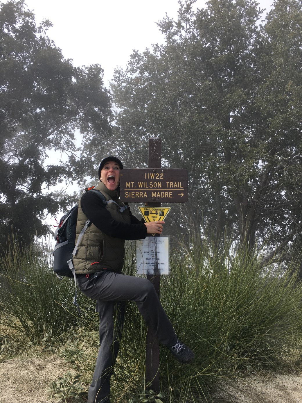
Time for the decent…I took the Mt. Wilson Trail to the Upper Winter Trail.  I was expecting all downhill, but was pleasantly surprised (NOT!) that there was a bit of incline with the Upper Trail (lol), but it wasn’t too bad.  The entire trail was beautiful, well marked, and clear for easy navigation.  My feet were sore, but my heart and soul were happy when I finally made it back to Adam’s Pack Station for a much deserved beer!  They have excellent grilled hamburgers as well.  Absolutely awesome hike and my first peak bagged of my Six-Pack of Peaks!!!

Stellar hike, stellar view, stellar exercise…Priceless! Happy Trails! ~Solo Yolo

Directions to Chantry Flats (Sturtevant Falls):

Take the 210 to Santa Anita Ave. and head north.  It is a very windy road, but a straight shot to Chantry Flats.  Make sure you arrive very early as the parking lot fills up by 6:30/7am on the weekends.  The entry gate is opened at 6am, unless there is weather/road condition closures.  Wilderness Pass must be displayed.  You may purchase a daily pass from Adam’s Pack Station for $5.  Annual passes will hopefully be available in February.

SoCal Hiker’s Blog of the Trails

Adams Pack Station

Sturtevant Camp

Info on road conditions/closures to Chantry Flats

Wilderness Pass Permits

John’s Meadow Overnight Snowshoe Trip, CA (7200′)

Nestled in the Southern California mountains of the San Gorgonio Wilderness, this short six mile trek provides you with the beauty and tranquility of the forest, solitude (during the winter only), as well as an awesome workout!

img_9217
John’s Meadow, San Gorgonio Wilderness, CA

The trail starts off of Jenks Lake Road West of Highway 38 in Angelus Oaks.  Make sure to carry cables/chains because the parking area is off a dirt road that may not be plowed.  The actual trail is hard to find in the winter. Go past the trailhead signage about a 100 yds where the dirt road begins to steepen and veers to the right.  You’ll see a sign for John’s Meadow if you’re on the right trail.  Not many people venture out on this trail during the winter, so odds are you’ll be making fresh tracks!

img_8779
Fresh Tracks!

Although I had my Delorme InReach, I enjoyed following animal tracks much of the way to camp.  I followed deer, coyote, rabbit, and bear tracks, something that I would most likely not have seen during the summer months.  I probably should’ve followed my map a little more as I did some steep sections and went through some shrubs, a little problematic with snowshoes! I cursed a few times or so! But hey, it’s the journey that matters, right?!! I think…

Right before camp is Forsee Creek.  It’s basically the only water supply during the summer months.  Crossing the creek is a little treacherous in snowshoes as there’s snow and ice covering the stream.  I grabbed a handful of bushes and propped my poles on logs and rocks to cross.  I probably should’ve taken off my snowshoes, but I was too darn lazy and confident I could make it across.  Thankfully, I didn’t fall in!  It wasn’t deep, but had freezing water with logs and rocks that would’ve been difficult to get out of.  Plus, being wet in the winter is a sure path to hyperthermia. Needless to say, I made it safely across and patted myself on the back for my success!

Less than 1/4 mile more is the glorious John’s Meadow.  Actually is not all that glorious, but very pretty, pristine, and you’re all alone, which makes it absolutely wonderful!  You can camp pretty much anywhere that you can find relative flat ground and away from hazards.  I was amazed at how much growth had happened since my last winter trek here.  I couldn’t camp in my same spot, but did find an area close by.  I stamped out a flat area with my snowshoes and made my condensation channels (as I have named them) for my tent.  I erected my North Face Assault 2 4-season tent, and had my Rumchata, Vodka, Malibu Rum “Boat Drink” to celebrate setting up camp and enjoying my solitude.

The evening was amazing with it’s absence of wind, dry temperatures, and a waning crescent that allowed for brilliantly bright stars to be gazed upon.  As always, I hit the hay shortly after eating and going through my normal nightly routine.  I was pleasantly pleased that absolutely no condensation built up on the walls of my single-walled tent.  WhooHoo! Life is good without darn condensation drips.  Although I probably shouldn’t say this, but I do pride myself on having an iron bladder during the night! I will, at all costs, refrain from having to get my clothes and boots on in order to go out of the tent, into the darkness of the forest, to take a tinkle…After all, there might be ANIMALS out there! Haha! But alas, nature called, so I had to acquiesce to its request! That was the only negative to the entire night.  The evening was just about perfect! 😉

img_8847
Good night! Sleep tight!

I am not an early riser, as my family and friends well know, even though I do wake up early.  I took my time getting up, performed my morning ritual of brushing teeth and making coffee.  I’ve always bragged about my $35 MSR stove special from Big 5, until this time.  It is a propane canister stove, and unbeknownst to me, freezes during cold temps.  I took the same stove last time, but I cooked in the vestibule of the tent, so it was warmer, and I didn’t have any problems.  Well, I had to shake it every so often to keep the flame going because the gas was freezing…Don’t mess with a woman and her coffee, let me tell you!

img_8853
Morning view through the tent vestibule

I broke camp and made my way back to the trailhead.  The journey back was a lot easier because it was easier to follow the trail going back and I didn’t make so many arduous climbs or bushwacking through shrubs.  Again, the weather blessed me with sunshine and no wind.  I never saw a soul the entire trip, postholed, made fresh tracks, followed animals, and had a starlit evening.  This is what life is about…Enjoying nature and getting in touch with your soul.  Now it’s time for Mexican Food! Buena comida and well deserved!!!

Happy Trails! ~Solo Yolo

Directions to trailhead: Hwy 38 to Angelus Oaks.  Turn right on Jenks Lake Rd West.  After about 1/3 mile, turn right again and go a half mile to Forsee Creek Trailhead parking.  A Forest Service Adventure Pass must be displayed.  Use the San Gorgonio Wilderness/Big Bear Lake topo map for this area. Wilderness permits available through Mill Creek Ranger Station (909) 382-2882.

Mill Creek Ranger Station

San Bernardino National Forest Home Page